Mapping Services

Maps
Demographic Analysis
Demographic Analysis
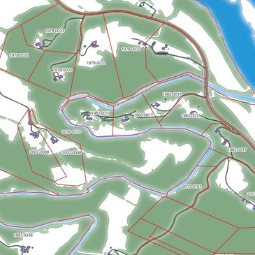
Property, income, neighborhood, land use, topography - it can all be displayed on a map. Add your own unique data to gain geospatial insights into your business or home.
We can also make custom maps - want a memorable souvenir of that epic touring vacation? Let us make you a map of your family's global travels. Tell us what you want to see on a map.

Demographic Analysis
Demographic Analysis
Demographic Analysis
Do your best customers all share a similar profile? We'll help you reach out to more like them and expand your customer base. How diverse is your business area? Find out where to expand your business with the best chance of success.

Geospatial Analysis
Geospatial Analysis
Geospatial Analysis
Geospatial analysis is about joining information with a place. Build a profile of your landscaping customers and focus on those with the acreage that maximizes your profits. Use a digital terrain model to find where your property is prone to flooding.
How can we answer your most challenging geospatial questions?

Aerial Imaging
Geospatial Analysis
Geospatial Analysis
From real estate photos and videos to photogrammetry and 3D modeling. Use a digital surface model to see how cutting down that tree will change the sight lines on your property. Provide a geospatially located 3D model of your building or property to your contractor to help with the design process. What do you need us to image for you today?
This website uses cookies.
We use cookies to analyze website traffic and optimize your website experience. By accepting our use of cookies, your data will be aggregated with all other user data.

Castle Hill Creations
Castle Hill Creations is a new service offering custom map themed home decor. All of the maps are custom made by us.